Rainfall
Monthly Rainfall Outlook: March 2020
Issued: 27 Feb 2020
For March 2020, below-normal rainfall is predicted for much of the region between 0° and 15°N.
For March 2020, all three models – NCEP CFSv2, ECMWF and the UK Met Office (Figures 1-3) – indicate an increased chance of below-normal rainfall for much of Southeast Asia between 0° and 15°N. This region broadly coincides with areas of moderate to high model skill (except Mainland Southeast Asia where the model skill is low to moderate).
There is a higher likelihood for above-normal rainfall for select regions in southern Southeast Asia (e.g. Sulawesi, Papua and Java Islands, Indonesia). However, predictions vary in intensity and spatial extent across models. Furthermore, corresponding skill scores are also low for this region.
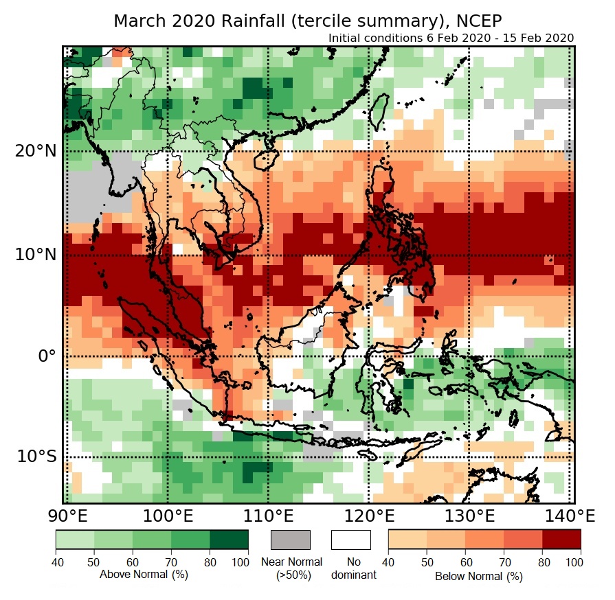
Figure 1: Rainfall tercile summary predictions of NCEP model for March 2020.
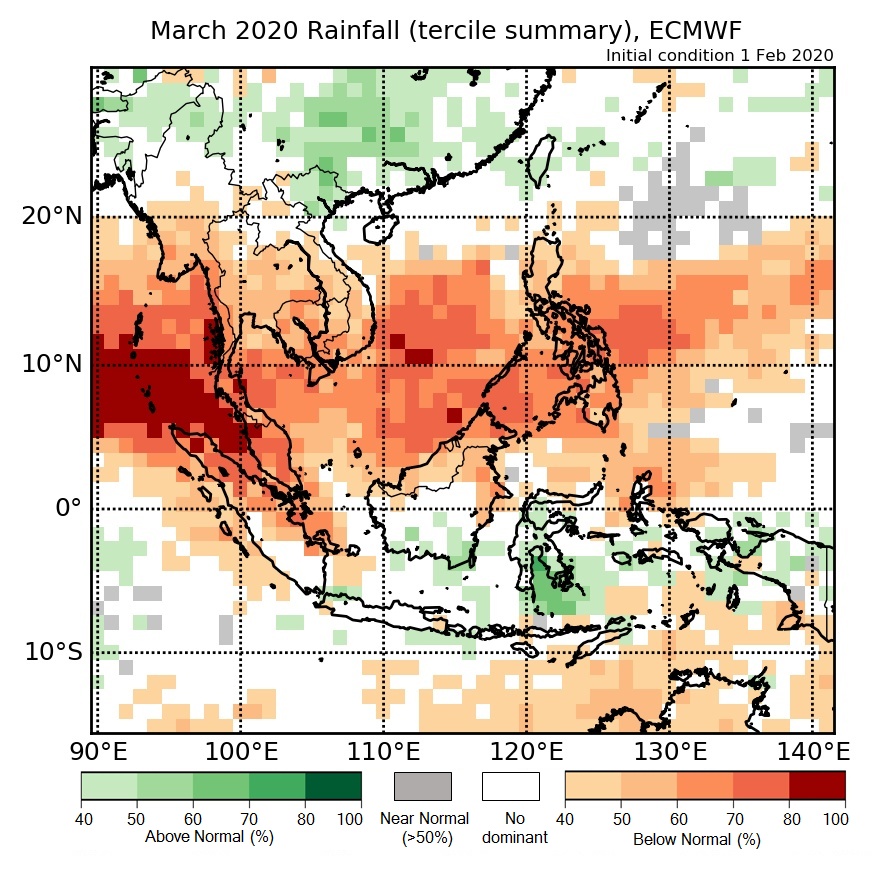
Figure 2: Rainfall tercile summary predictions of ECMWF model for March 2020 (contains modified Copernicus C3S information).
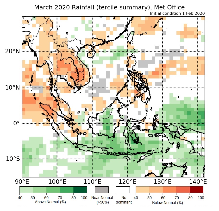
Figure 3: Rainfall tercile summary predictions of UK Met Office model for March 2020 (contains modified Copernicus C3S information).
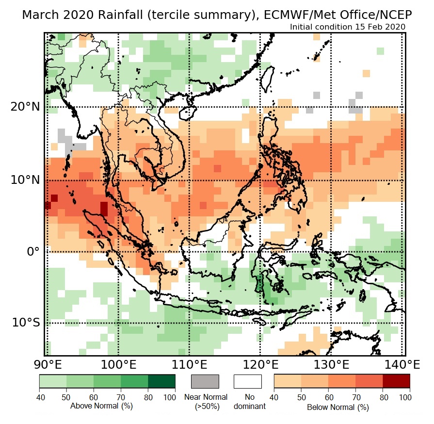
Figure 4: Rainfall tercile summary predictions of multi-model ensemble model for March 2020 (contains modified Copernicus C3S information).