Rainfall
Monthly Rainfall Outlook: April 2020
Issued: 30 Mar 2020
For April 2020, below-normal rainfall is predicted for much of the region between 0° and 20°N.
For April 2020, all three models – NCEP CFSv2, ECMWF, and UK Met Office – predict an increased chance of below-normal rainfall for parts of Southeast Asia between 0° and 20°N (Figures 1-3). However, one of the three models – UK Met Office (Figure 3) – predict this drier region to be confined only to the western part (i.e. not including the Philippines). Model skill for this region (0° and 20°N) is moderate to good.
In southern Southeast Asia, all three models predict a higher likelihood for above-normal rainfall for some parts (e.g. Sulawesi, Papua and Java Islands, Indonesia). However, across models, predictions vary in intensity and spatial extent and the corresponding skill scores are low for this region.
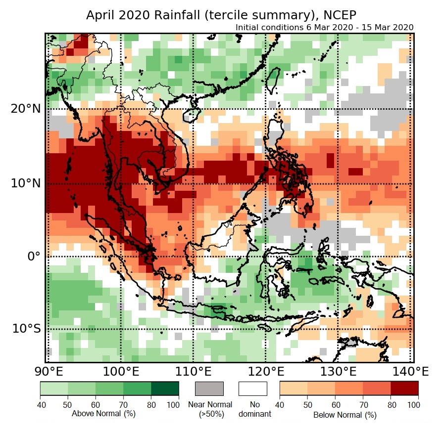
Figure 1: Rainfall tercile summary predictions of NCEP model for April 2020.
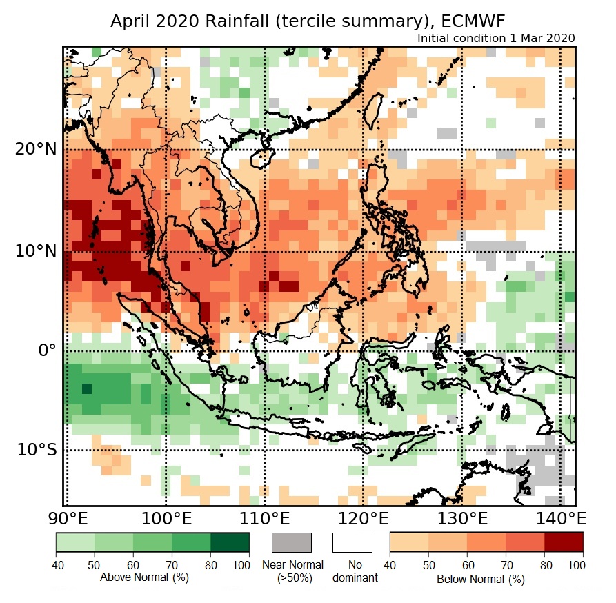
Figure 2: Rainfall tercile summary predictions of ECMWF model for April 2020 (contains modified Copernicus C3S information).
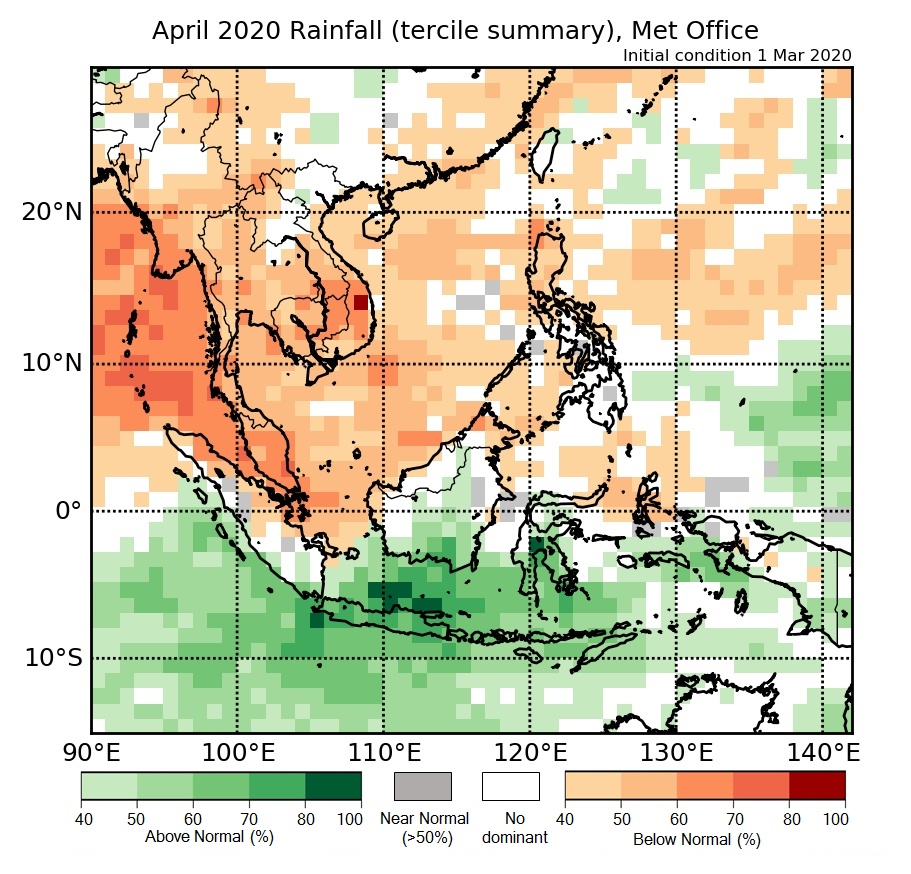
Figure 3: Rainfall tercile summary predictions of UK Met Office model for April 2020 (contains modified Copernicus C3S information).
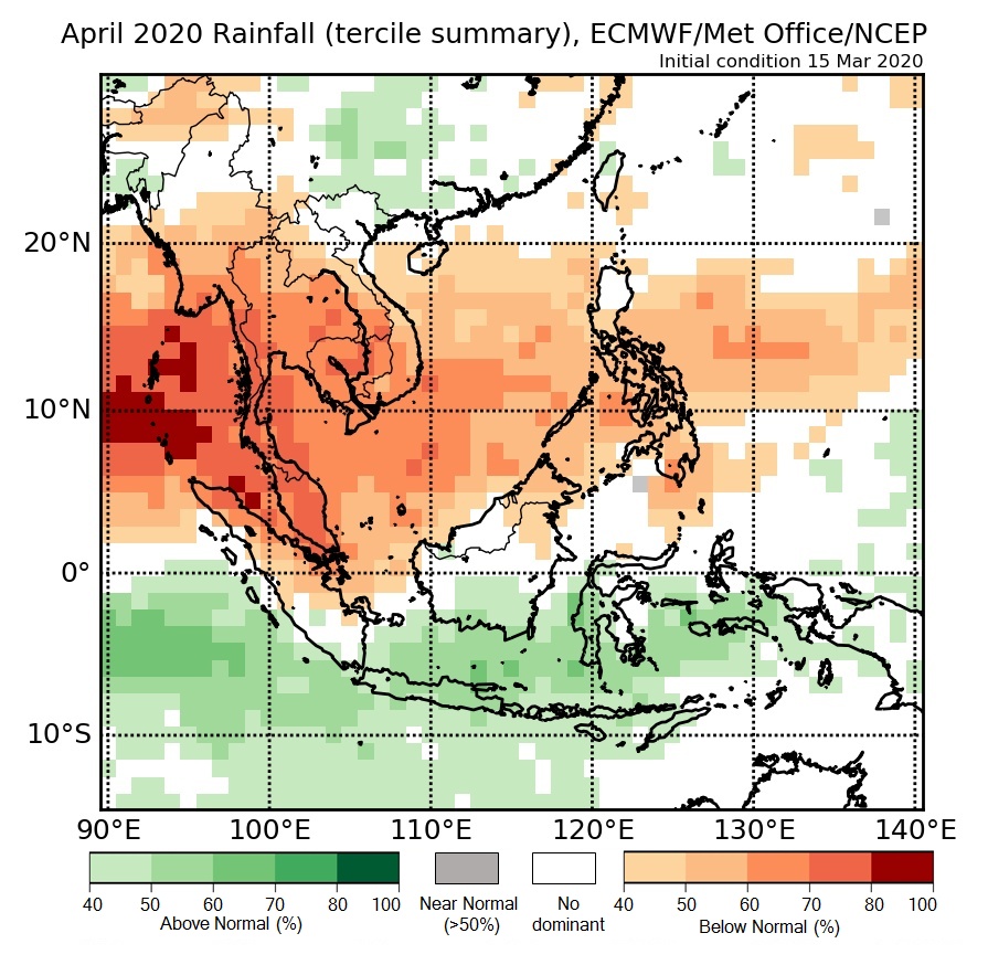
Figure 4: Rainfall tercile summary predictions of multi-model ensemble model for April 2020 (contains modified Copernicus C3S information).