Rainfall
Monthly Rainfall Outlook: February 2020
Issued: 30 Jan 2020
For February 2020, below-normal rainfall is forecasted for much of the region between 0° and 10°N. There is also an increase chance of above-normal rainfall in the northern most parts of Southeast Asia.
For February 2020, two models – NCEP CFSv2 and the ECMWF (Figures 1, 2) favour an increased chance of below-normal rainfall for much of the Southeast Asian region between 0° and 10°N, including northern Sumatra, Peninsular Malaysia and the Philippines, while the UK Met Office model predicts below-normal rainfall for only northern Sumatra and parts of the Philippines (Figure 3). However, all three models, NCEP CFSv2, ECMWF, and UK Met Office are forecasting an increased probability of above-normal rainfall for the most northern parts of Southeast Asia. With regards to model skill, the region where below-normal rainfall is forecasted corresponds to the area with moderate to high skill, while the region where above-normal rainfall corresponds to one with only low to moderate skill.
Elsewhere, the models show inconsistent forecasts or have limited skill.
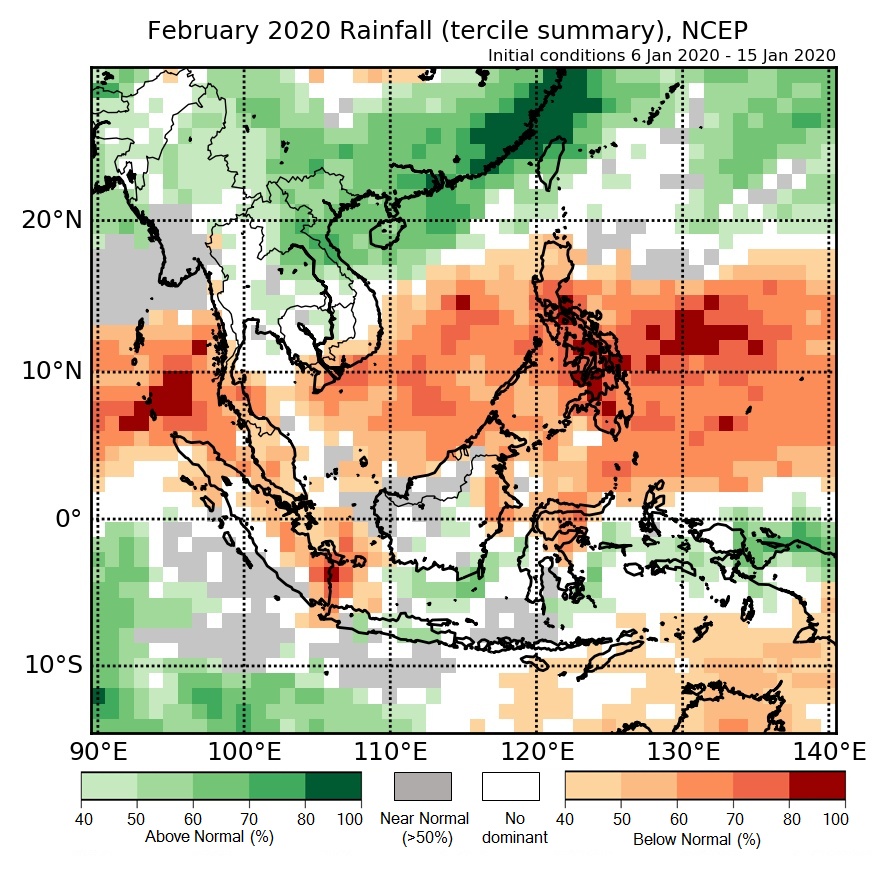
Figure 1: Rainfall tercile summary predictions of NCEP model for February 2020.
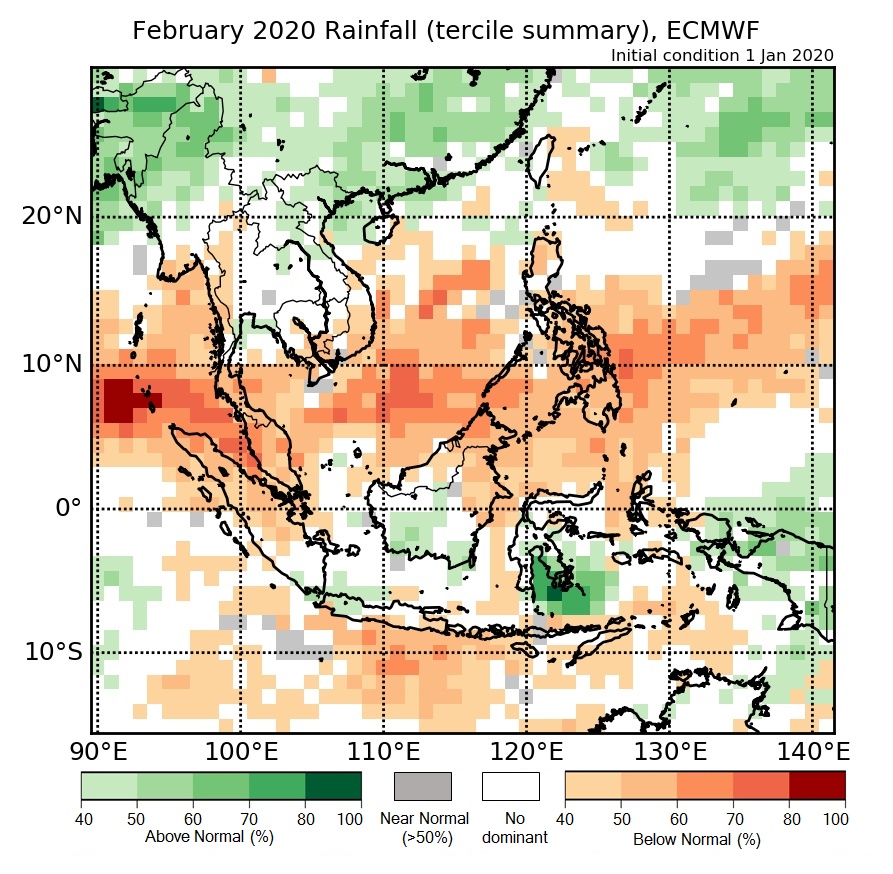
Figure 2: Rainfall tercile summary predictions of ECMWF model for February 2020 (contains modified Copernicus C3S information).
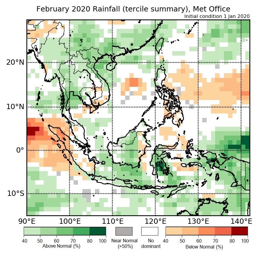
Figure 3: Rainfall tercile summary predictions of UK Met Office model for February 2020 (contains modified Copernicus C3S information).
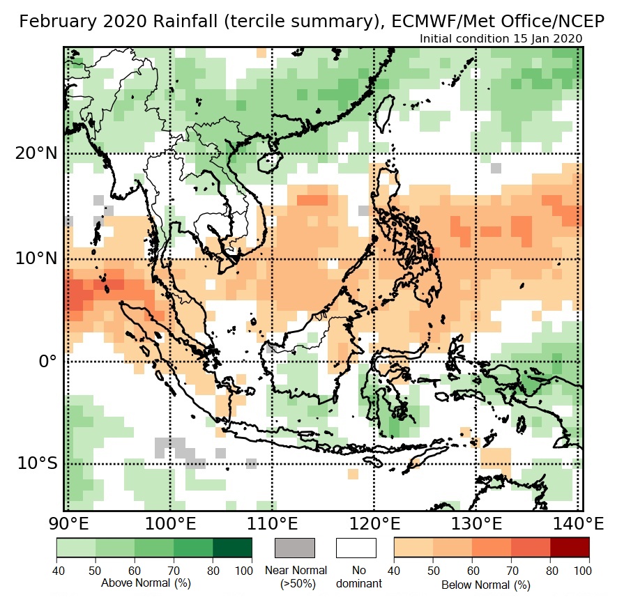
Figure 4: Rainfall tercile summary predictions of multi-model ensemble model for February 2020 (contains modified Copernicus C3S information).