Rainfall
Monthly Rainfall Outlook: June 2020
Issued: 28 May 2020
For June 2020, models indicate an increased chance of above-normal rainfall for parts of Southeast Asia around the equatorial region. However, models differ on the spatial extent of the regions with above-normal conditions.
For June 2020, the most coherent signal across the three models – NCEP CFSv2, ECMWF, and UK Met Office – is the increased chance of above-normal rainfall for parts of Southeast Asia around the equatorial region (Figures 1-3). However, the spatial extent of the above-normal conditions differs markedly in NCEP CFSv2 (Figure 1) – more northwards compared to the other two models (Figures 2, 3). However, NCEP CFSv2 model skill is lower for the equatorial region than the other two models. All three models also predict above-normal rainfall for regions around Java, where there is relatively good skill for all three models.
For the rest of Southeast Asia, there is no consistent or coherent outlook for rainfall for June 2020. These discrepancies are in line with the relatively lower skill for June rainfall.
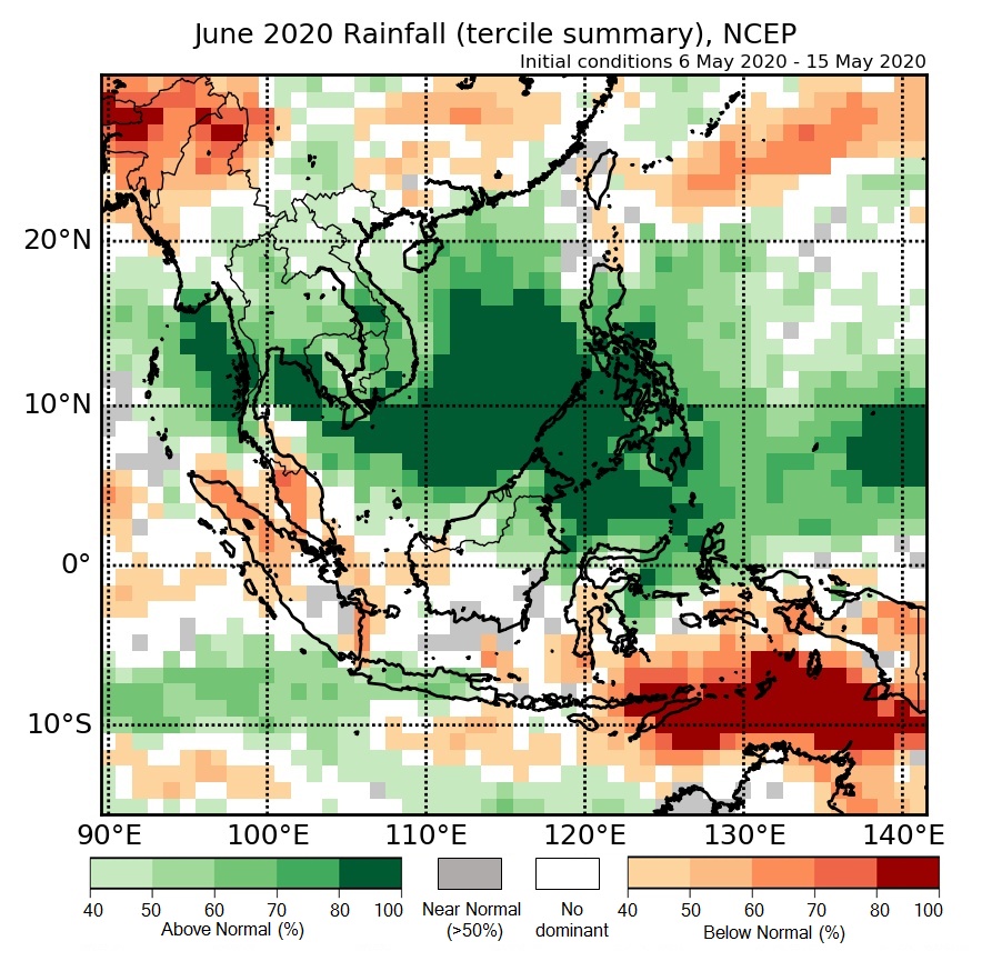
Figure 1: Rainfall tercile summary predictions of NCEP model for June 2020.
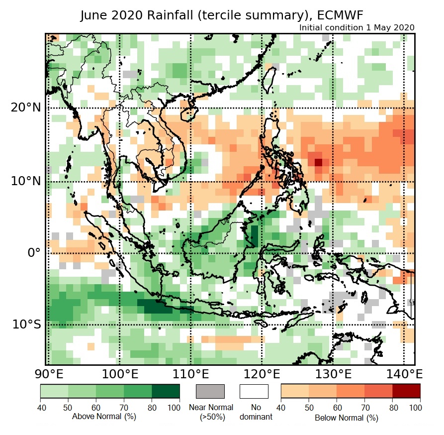
Figure 2: Rainfall tercile summary predictions of ECMWF model for June 2020 (contains modified Copernicus C3S information).
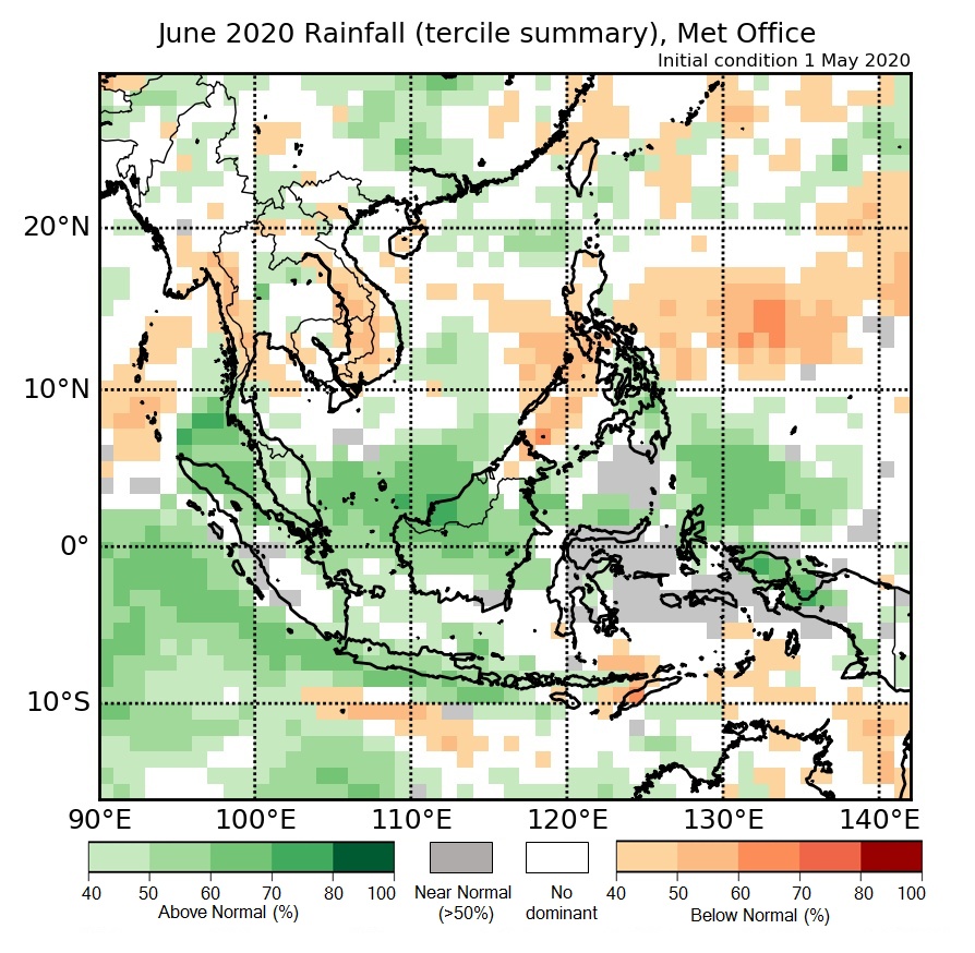
Figure 3: Rainfall tercile summary predictions of UK Met Office model for June 2020 (contains modified Copernicus C3S information).
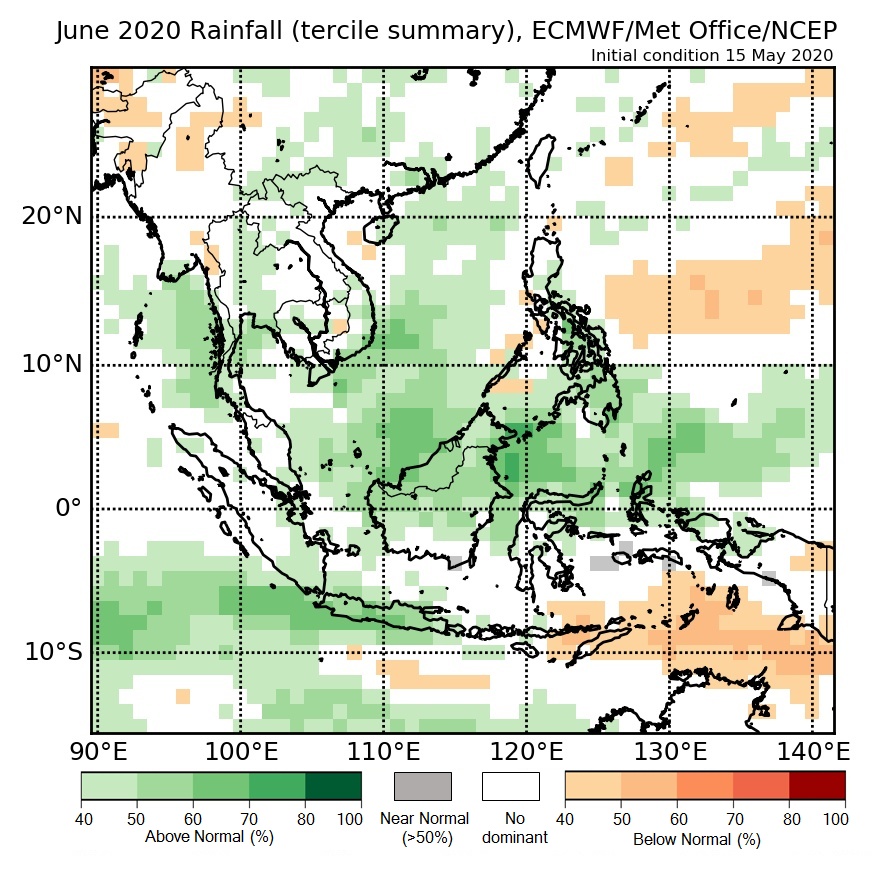
Figure 4: Rainfall tercile summary predictions of multi-model ensemble model for June 2020 (contains modified Copernicus C3S information)