Rainfall
Monthly Rainfall Outlook: August 2020
Issued: 30 Jul 2020
For August 2020, predictions for most of Southeast Asia either are inconsistent across models, or have low skill, apart from an increase in chance of above-normal rainfall in the eastern equatorial region.
For August 2020, above-normal rainfall is predicted in the eastern equatorial region in two of the models – ECMWF and UK Met Office (Figures 2, 3), while the third model – NCEP (Figure 1) predicts below- to near-normal rainfall. The skill is relatively good for the ECMWF and UK Met Office models, indicating an overall increase in above-normal rainfall for this region. The three models agree with above-normal rainfall as the dominant tercile for the band around 10°N, however, the skill is low for this region for all three models, and the likelihood of above-normal rainfall is lower for the ECMWF and UK Met Office models.
For the rest of Southeast Asia, there is either disagreement between the models (southern Maritime Continent) or the skill is low for this time of year (northern Southeast Asia).
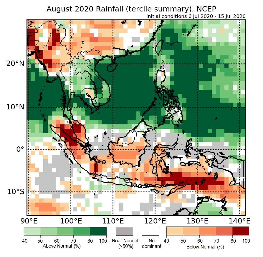
Figure 1: Rainfall tercile summary predictions of NCEP model for August 2020.

Figure 2: Rainfall tercile summary predictions of ECMWF model for August 2020 (contains modified Copernicus C3S information).

Figure 3: Rainfall tercile summary predictions of UK Met Office model for August 2020 (contains modified Copernicus C3S information).
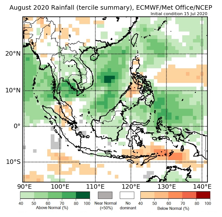
Figure 4: Rainfall tercile summary predictions of multi-model ensemble model for August 2020 (contains modified Copernicus C3S information).