Rainfall
Seasonal Rainfall Outlook: August-October 2024 (ASO)
Issued: 31 Jul 2024
For ASO 2024, models predict above-normal rainfall for much of the Maritime Continent.
For ASO 2024, above-normal rainfall is predicted for much of the Maritime Continent, in particular over the eastern region, based on the multi-model ensemble (Figure 4). The UK Met Office model (Figure 3) shows the highest confidence for above-normal rainfall over the mentioned region, followed by the NCEP model (Figure 1) and then the ECMWF model (Figure 2). The NCEP model predicts below-normal rainfall around the Malay Peninsula, while the ECMWF and UK Met Office models predict near to above-normal rainfall over the region. Models’ skill is relatively good for above-normal rainfall over much of the Maritime Continent, except for over the Philippines and the Malay Peninsula where skill is low to moderate.
Above-normal rainfall is predicted over most of central and eastern parts of Mainland Southeast Asia, with no dominant tercile elsewhere, based on the multi-model ensemble (Figure 4). The UK Met Office model (Figure 3) predicts the largest extent of above-normal rainfall over Mainland Southeast Asia, while the NCEP and ECMWF models (Figures 1 and 2) predict above-normal rainfall over much of the central and eastern regions. A mix of below- to above-normal rainfall or no dominant tercile is predicted by the NCEP and ECMWF models for western Mainland Southeast Asia. The models’ skill is generally low over Mainland Southeast Asia.
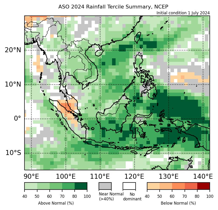
Figure 1: Rainfall tercile summary predictions of NCEP model for ASO 2024 (contains modified Copernicus C3S information).
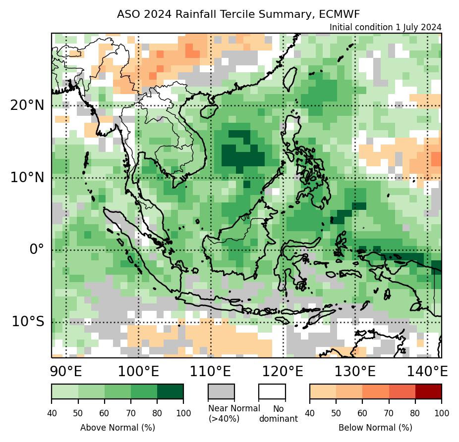
Figure 2: Rainfall tercile summary predictions of ECMWF model for ASO 2024 (contains modified Copernicus C3S information).
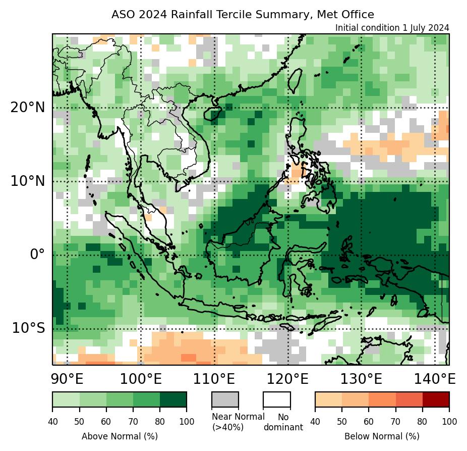
Figure 3: Rainfall tercile summary predictions of UK Met Office model for ASO 2024 (contains modified Copernicus C3S information).
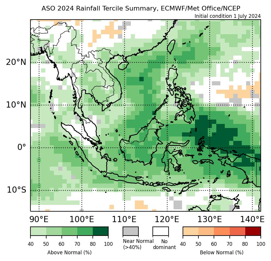
Figure 4: Rainfall tercile summary predictions of the multi-model ensemble for ASO 2024 (contains modified Copernicus C3S information).

Figure 5: Average climatological rainfall's lower tercile boundary for Oct based on CHIRPS (Reference period: 1991-2020).

Figure 6: Average climatological rainfall's upper tercile boundary for ASO based on CHIRPS (Reference period: 1991-2020).
The qualitative outlook is assessed for the region in general. For specific updates on the national scale, the relevant ASEAN National Meteorological and Hydrological Services should be consulted.